Hiking La Gomera
 La Gomera is a perfect place for a hiking trip. It has a fantastic range of well maintained, well marked trails, a mild climate year round, and spectacular scenery. It is a small island, but has an interesting range of different terrain in which to hike.
We hired a car which made access to the start of all the walks we did really easy. There is a bus service (which we used for a linear walk), but this is slightly limiting in terms of destinations served and schedule. We saw several people looking to hitch a ride (unfortunately always in the opposite direction to where we were headed) so this is an option if you are not someone who has to get places in a hurry. All the larger settlements had taxis and we saw quite a few hikers making use of these to get around if you don’t want to drive.
We found it easy to get parked and none of the trails we used were busy. You can either take a guided walk in a group, there are several operators on the island who offer this option, or head out with a map by yourself. We did the latter option and didn’t experience any issues.
For more general tips on a trip to La Gomera, including where to stay and how to get there, check out on blog post on Visiting La Gomera.
The Terrain
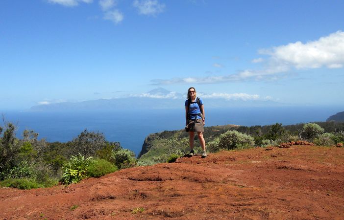
On the trail with my trusty walk book
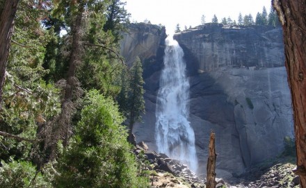
La Gomera is very, very mountainous. The island is a series of very steep sided ravines leading down into the sea. This means you will end up doing plenty of vertical, so you will need to be in OK shape for the uphill (or at least determined) and have decent knees for the downhill.
My husband was concerned before we went, due to the warnings about some of the paths being very vertiginous. He thinks I suffer badly from vertigo as on our first trip to the Lake District together he decided we would hike Helvellyn by going up Swirral Edge and down Striding Edge. He was fine but suffice to say I did not enjoy the way down one bit.
After all my husband’s witty remarks about not knowing the Spanish for “my wife is crag fast”, I was a little nervous when we set off up the incredibly steep cliff at the back of Agulo. However, these fears were unfounded. I was fine. There were a couple of places I would not liked to have spent the afternoon, but nowhere where I felt frightened. If, however, you genuinely suffer with vertigo, the sort of person who feels a bit wobbly if you have to stand on a chair, many of the walks we did in La Gomera will not be enjoyable and your choice of walks may be a little restricted.
The Hikes
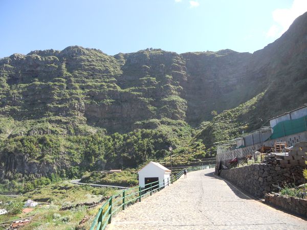
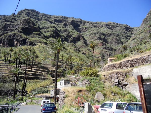
The cliff at Agulo
We did 6 long hikes during our trip and a quick dash up to the summit of Garajonay one day as it was clear of cloud. We did mainly circular hikes as it meant we could be as tardy as we pleased without having to worry about bus schedules.
We averaged around 9 – 12km a hike with a 650m elevation change. We carried about 1.5l of water each and tended to drink the lot unless we had visited a café. If we went any later in the year I would take at least 2l per person for a hike of this duration. We slept very well every night…..
We enjoyed all the hikes we did, but 3 stand out as particularly great.
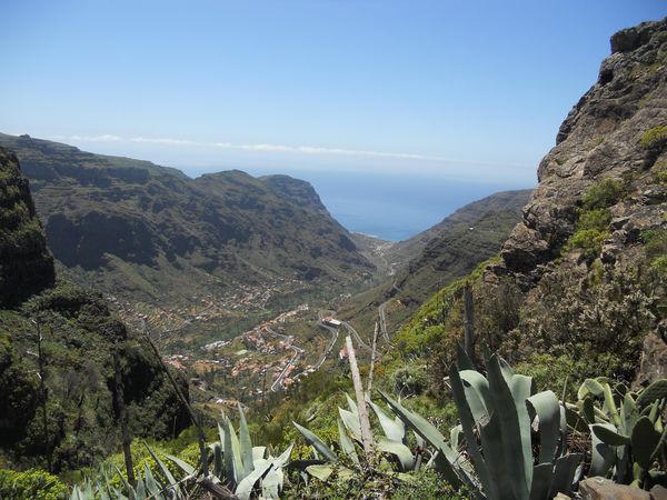
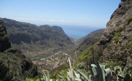
Hike 31 from our book was a circular hike from Agulo. The route we took out of Agulo was incredible. We basically walked up the cliff behind the village. It was very steep and I would hate to try and walk down it.
The book warned of a couple of vertiginous sections, but there has obviously been a lot of recent improvements to the path, including a handrail on one of the narrower sections with a sheer drop.
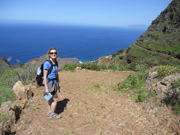
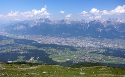
Posing in front of Mount Teide
After much up, all 600m of it, we eventually popped out by a bar / restaurant and a Garajonay Visitor Centre. We decided to have lunch first and my husband confidently ordered what he thought was 4 tapas dishes, thinking this would be a nice light lunch. Our tortilla, cheese, chick peas and bread duly arrived. There was a short wait and then a huge plate of fried pork appeared, complete with a load of chips. We decided that we may as well do it justice and left quite some time later, feeling rather fuller than we had originally intended. This is what comes of having very limited Spanish and deciding to answer an unknown interrogative with a smile and “si”. Hey. It all tasted good. The fact that both of us had to let the waist straps on our rucksacks out a bit seemed a very small price to pay. From the top of the ridge there is an excellent view of the whole of Tenerife, Mount Teide looking particular majestic with its top popping up through its collar of cloud.
One cloudy day, we decided to do walk 28 from our book, out of Vallehermoso. Some hiking friends of ours recommended it as one of their favourite walks on the island. We could soon see why. The valley is absolutely beautiful. Lush and verdant looking, dotted with palms and very eden like. Just lovely. The path was a nice easy grade too, as well as being easy to follow which we particularly appreciated in the rain. The rain stopped as we got to the only exposed and steep section of the route up, which was great. By the time we reached the top we were able to sit and eat our sandwiches in watery sunshine.
The cliff at Barranco de Hayas
I had regretted packing sandwiches as our friends had said the food at the restaurant halfway round our walk, Restaurante Roque Blanco, was good. In the event I was glad I had as the inclement weather had led to the restaurant being shut for the afternoon. I imagine there was a lack of customers from the usual walkers and people coming to gaze from the viewpoint.
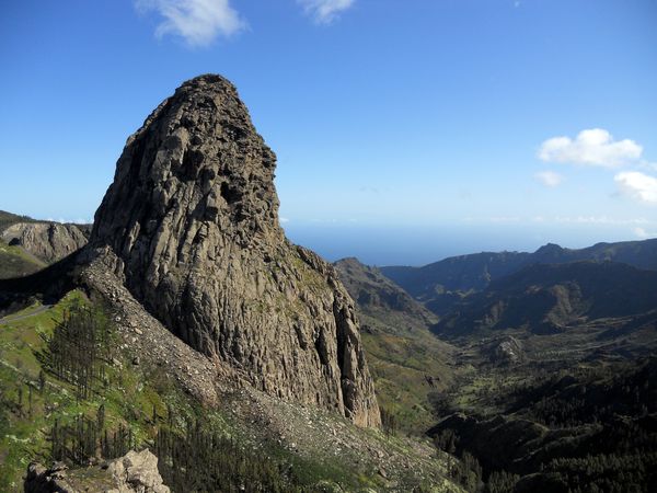
The route back down towards Vallehermoso, past the massive edifice of Roque Cano is a lovely walk. Again, a really nice easy path. The rain had finally quit for a time as well so we were walking in sunshine with an increasing view of the valley. Truly beautiful.
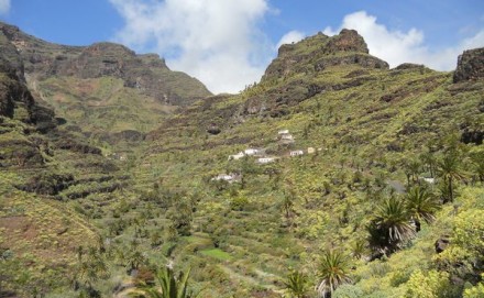
Our final top pick is hike 16 from the book, up the ridiculously steep Barranco de Hayas. It is definitely a lung buster but the views of Valle Gran Rey are so worth it. There is a convenient bar / restaurant in Hayas. Safe in the knowledge that we had done all the hard work, we treated ourselves to an ice cream before we took the path down. This is a lovely grade with amazing views all the way down. Brilliant.
Maps and Walk books

We bought Walk! La Gomera by Charles Davies and found this a really good book. The walks were well described, we managed to follow the routes fine, and we really liked the routes chosen. There are several books available, but we would definitely recommend this one.

to go with it, but for some reason I decided to go for a different map. I think it was a vague feeling of eggs and baskets.

map. The only reason this was problematical is that it didn’t have all the paths shown that were in the walk book we had bought, despite being a decent scale.
What else to take
In addition to your map and hiking book, you will need a good pair of hiking boots, a lightweight waterproof, a sun hat, a decent rucksack that will carry plenty of water and high factor sunscreen. I also carried a warm layer.
The waterproof may seem a bit odd if you set off in blazing sunshine, but cloud can form very quickly on the island, especially near the summit of Garajonay. We were glad of ours a couple of times. In early April I found factor 50 sun screen was a better bet than factor 30, especially on bare shoulders as we were hiking through the middle of the day. If you don’t have a hat on, you will definitely need factor 50 on your nose when the sun is this high!
We had a lengthy debate around which walking boots to take, and ended up taking this type of thing, a heavy walking shoe.

This was fine on all the uphill, and on the majority of the trails we did. A couple of the descents we did however, we quite steep and I wished I had a boot that held by foot in place more firmly – my toes ended up pushed to the end of my shoe giving me very painful blisters on the ends of a couple of toes. Consequently when we go back I will take this kind of thing.

For more advice on what to take, check out our page on day hiking equipment, and our handy printable packing checklists.

